|
1.1 |
Map
of units of Petersburg National Battlefield |
|
2.2 |
Detail
of Main Unit on USGS Prince George and Petersburg quads |
|
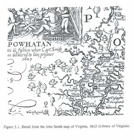
3.1 |
John
Smith map of Virginia, 1612 (Library of Virginia) |
|
4.1 |
Jefferson
and Fry map of Virginia, 1751 (Library of Virginia) |
|
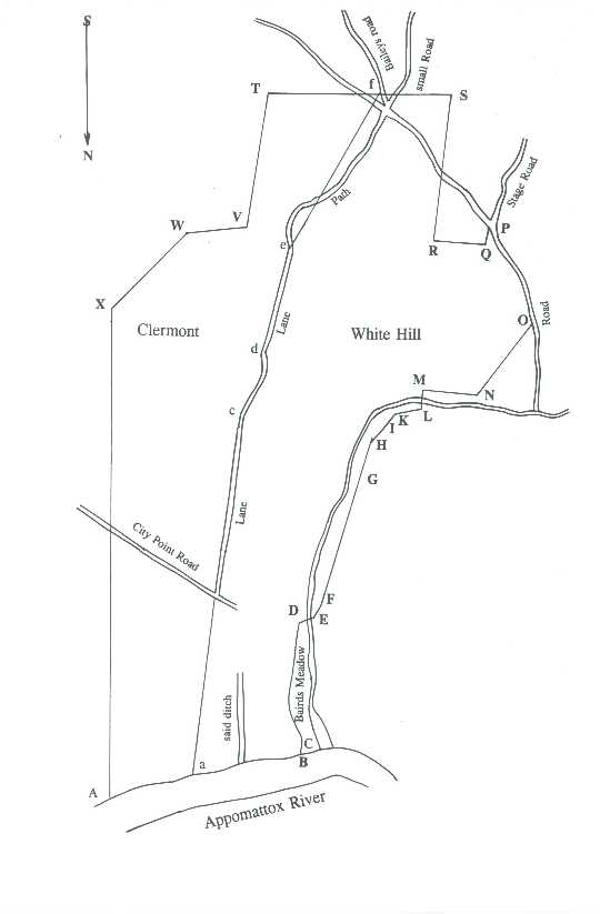
4.2 |
1797
survey plat of "Clermont" and "White Hill" (PG Co.
Surveyor's Record) |
|
4.3 |
County
A Map and Profile of City Point, 1837 (Library of Virginia) |
|
4.4 |
Campbell
Map of the approaches to Petersburg and their defenses 1863 (O.R.
Atlas Plate XL, No. 1) and modern topographic data (Muller GIS plan) |
|
4.5 |
Engineer
Department map, July 1864 (O.R. Atlas Plate LXIV, No.1) |
|
4.6 |
Engineer
Department Map of the environs of Petersburg..., 1866 (O.R. Atlas Plate
LXXIX, No. 1) |
|
4.7 |
Michler
map of Petersburg battlefield No. 6, 1867 (National Archives) |
|
4.8 |
USGS
Petersburg map of 1894, reprinted 1917 |
|
4.9 |
Martin
Topography...Battery No. 5, April 1935 (National Park Service) |
|
4.10 |
Chalifoux
Topography, May 1935 (National Park Service) |
|
4.11 |
Chalifoux
and Shelhouse Topography, May 1935 (National Park Service) |
|
4.12 |
USGS
Prince George map of 1946, reprinted 1949 |
|
4.13 |
NPS
The Master Plan of 1942, No. 6, Fort Stedman VicinityCUtility Group |
|
4.14 |
Another
detail from NPS The Master Plan of 1942, No. 6. |
|
4.15 |
NPS
The Master Plan of 1942, No. 7, The CraterCColquitt's Salient and Fort
Morton Area |
|
4.16 |
Eighteenth
and nineteenth-century plantations and farm sites |
|
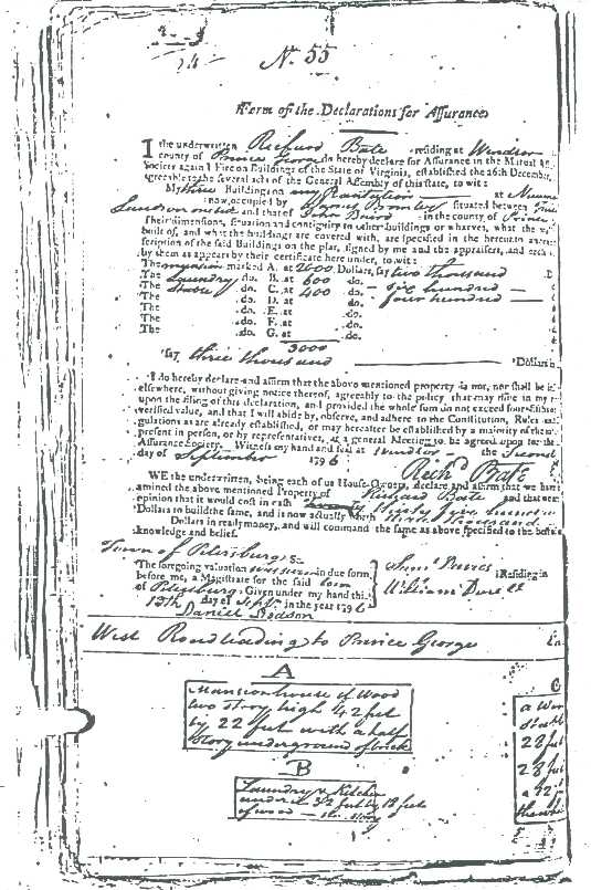
4.17 |
Plan
of Bate (later Hare) plantation, 1796 (Mutual Assurance Society) |
|
5.1 |
Dimmock
batteries 6-8, Friend and overseer's? houses (Michler 1867, NA) |
|
5.2 |
Knowles
map of Union regimental encampments in 1865 (Hodgkins 1889) |
|
5.3 |
Dunn
and Gibbons houses and Dimmock batteries 9-12 (Michler 1867, NA) |
|
5.4 |
Plan
of Bate (later Hare) plantation, 1805 (Mutual Assurance Society) |
|
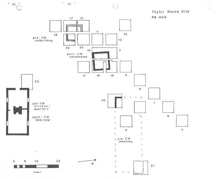
5.5 |
Excavation
plan, Taylor house site, 1978 and 1981 (Blades 1993) |
|
5.6 |
Harrison
Creek line, rear of Fort Haskell and Fort Morton (Michler 1867, NA) |
|
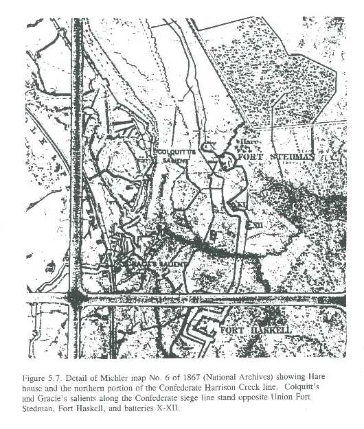
5.7 |
Hare
house, Confederate salients, Union forts and batteries (Michler 1867, NA) |
|
5.8 |
Union
batteries XIII-XVI and Fort Morton (Michler 1867, NA) |
|
5.9 |
Confederate
earthworks including Elliott's Salient (Michler 1867, NA) |
|
6.1 |
1863
map of Petersburg and defenses and modern hydrographic data (Muller GIS
plan) |
|
6.2 |
Major
Civil War earthwork remnants or sites within Main Unit |
